Wednesday, August 28, 2024

Implications of an upright Altar Stone in WA 3639

In the previous post (Is the Altar Stone the founding stone of Stonehenge?) I wrote that perhaps Atkinson was correct when he suggested the Altar Stone might have once stood upright in the stonehole he found immediately southwest of Stone 56, the one with the Group I Cornish polished stone axe deliberately placed in its primary fill.

I went on to suggest that perhaps the Altar Stone and the Station Stones comprised the first stones on the site, as they would be the minimum that would be necessary to fix the Sky to the Earth and encode all the solar and lunar alignments.

The stonehole that Atkinson suggested is at the base of a feature catalogued as "WA 3639".


Position of WA 3639 and the suggested stonehole, from Cleal et al 1995

It's in an interesting place, being on the primary solar axis (Summer Solstice Sunrise to Winter Solstice Sunset), bang up against (and partly under) the large lumpy fragment of Stone 15, midway between Stone 56 (the tallest stone on the site, one upright of the now-fallen tallest trilithon of 55-56-156) and the massive block that is Stone 16.

I wondered if the position was at all significant in terms of the minimal arrangement of stones, so I reached for the 2012 paper "Stonehenge Remodelled" (Darvill et al) because I knew it had a selection of plans of the various "Stages" of the monument through its life. These were originally in Cleal et al, but were amended to illustrate the consensus view that Darvill, Marshall, Parker-Pearson and Wainwright arrived at.

Overlaying the plans to show just the Station Stones and an upright Altar Stone in the position of WA 3639 was simple enough. I also retained the Heelstone, Stonehole 97, the Aubrey Holes, the banks and ditches and the causeway postholes (since they're all potentially early features).
Altar Stone (green) positioned upright in WA 3639, Station Stone rectangle in red

I then added the interior postholes that Hawley discovered in his 1919-26 excavations, since they're possibly early features too, together with Stoneholes B and C outside the causeway entrance in the NE.

As above, but with Hawley's interior postholes and Stoneholes B and C included

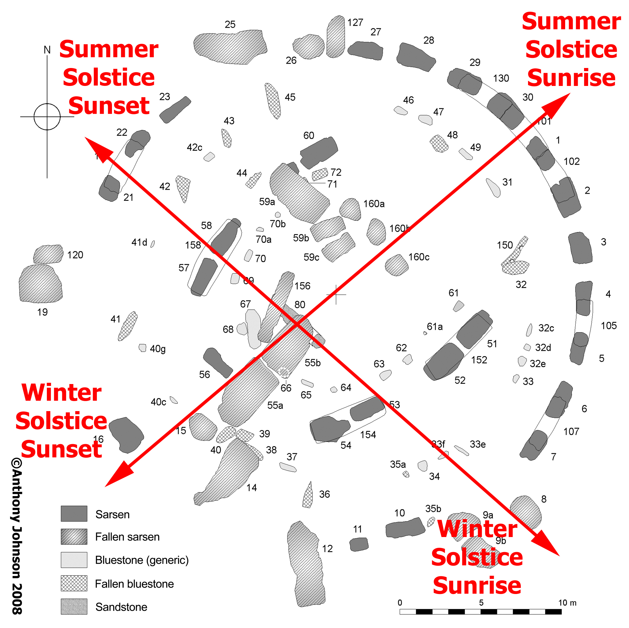
Next step was to draw in the primary solstice alignment line, through the Altar Stone (since WA 3639's stonehole is on this axis) and to the left of the tip of the Heelstone which is where the Sun rose 5000 years ago when the Earth's tilt was 24° rather than the 23.5° it is today.

Primary solstice axis is in orange
Summer Solstice Sunrise (top right) to Winter Solstice Sunset (bottom left)

Last step was to take that primary axis line and rotate it 81°, which was the angle between Summer Solstice Sunrise and Winter Solstice Sunrise 5000 years ago, and drop that over the Altar Stone position.

I was not expecting what happened when I did that.

Secondary solstice axis added in orange
Winter Solstice Sunrise (bottom right) to Summer Solstice Sunset (top left) 

I did that last operation when zoomed in close, so I could get the intersection point of the axes exactly over the Altar Stone's position.

When I zoomed out, I was astonished to see that this secondary axis also intersects Station Stone 93.

Not only that, but it also follows the line of postholes that define the unexplained "arrowhead"-shaped arrangement at the end of the Southern Causeway corridor.

I need to do this again, with the high resolution images from Cleal et al to be certain it's what it looks like, but what it looks like is that there's a sightline that runs from Station Stone 93 via the postulated upright Altar Stone in WA 3639 to the Winter Solstice Sunrise position over Coneybury Hill.

It may not hold up to detailed scrutiny when I do that reworking, but for now this is potentially very exciting - at least for me.

Update: 29th Aug 2024

Doing this again using the vector illustrations of Plan 1 and Plan 2 from Cleal et al, the alignment is not quite as precise as with the ones from "Stonehenge Remodelled" in that the alignment just misses Station Stone 93's SW face.

This in itself is interesting, because it means there'd be a very tightly constrained sightline between that face of the Station Stone and the NE face of the proposed upright Altar Stone which frames the appropriate place on the horizon - Winter Solstice Sunrise to the SE and Summer Solstice Sunset to the NW.

Arguably, given another tightly constrained sightline that makes use of pair of stones to create a viewing portal, this is actually more convincing.

Here's the result:

Same construction but using the plans from "Stonehenge in its Landscape" Cleal et al, 1995

You might notice that there's now a second red "blob" in the interior of the monument. The one to the SW is the proposed upright Altar Stone in WA 3639, and the other in the NE is... well.

While trawling through Cleal looking for anything relevant to this endeavour, I came across the following comment relating to the NE end of the Bluestone oval setting:


This is somewhat difficult to parse but it drew my attention to WA 2730, positioned as shown below, just to the bottom right of the middle of the image:
Feature WA 2730, just inboard of the Bluestone circle in the NE quadrant of the monument

This is an odd feature, it appears completely unrelated to the other settings but is about 1.5m NE of the only grave ever discovered in the interior of the stone circle. What happens if you put a stone here?

Such a stone, together with the proposed upright Altar Stone in WA 3639, lies on the primary solstice alignment. Curious and, although Atkinson's comment about a possible pair to the Altar Stone is probably referring to a stonehole near Stone 55 in the SW rather than at the NE end of the interior, it intrigues me.

Could there have been a second Altar Stone in the interior?

This is a rabbit hole that many people have gone down - starting with Inigo Jones' and John Aubrey's comments about a "supposed Altar Stone" in the middle of the "cell" (the innermost part of Stonehenge) "towards the east" that Philip, Earl of Pembroke, reported had been "carried away to St. James' (Westminster)".

I'm going to leave it to others to deal with that conundrum!

Tuesday, August 27, 2024

Is the Altar Stone the founding stone of Stonehenge?

You've got to be pretty motivated to bring a 6 ton lump of sandstone from the environs of the Orcadian Basin to Stonehenge (see The Scottish Stone article).

Let's, for the sake of argument, say that it's actually from Orkney. What else do we find there?

The list is pretty impressive, a few highlights are:

The Stones of Stennes - possibly the oldest "henge" monument in Britain - a henge being an enclosing earthwork with a bank on the outside and a ditch on the inside - with a 30m wide stone setting in the interior, oval in form with a central hearth. Roughly 5,100 years old.

The Ring of Brodgar - a perfectly circular stone circle 104m in diameter, within a bank and ditch (but with the ditch outside the bank, so not technically a "henge"). Roughly 4,500 years old.

Maes Howe - a chambered cairn and passage grave 35m in diameter, oriented to the setting Winter Solstice Sun. Roughly 4,800 years old.

Skara Brae - a settlement of ten stone-built houses that was discovered after a winter storm stripped the earth from a knoll in 1850 CE. Roughly 5,200 years old.

The Ness of Brodgar - sited on the spit of land between the Stones of Stennes and the Ring of Brodgar, this is a complex of stone-built structures that were first noticed in 2003 CE. Variously described as a "temple complex" or even a "university"(!), this is remarkable site with decorated, carved and painted walls and a striking artistic iconography. Roughly 5,500 years old, but deliberately closed down and abandoned after a huge feast in about 2,200 BCE.

The people inhabiting this region had to have been competent mariners - the strait separating Orkney from the mainland (the Pentland Firth) has some of the most powerful tides in the world.

Their origins are unclear, but Cunliffe, Renfrew, Collins, James, Prior and Oppenheimer all suggested that the arrival of a culture originating in the Iberian peninsular (perhaps emerging from the Mediterranean basin) and travelling by sea along the Atlantic western fringe of Europe is a possibility.

In Oppenheimer's 2006 book "The Origins of the British" he writes:

"...75-95% of British Isles (genetic) matches derive from Iberia... Ireland, coastal Wales, and central and west-coast Scotland are almost entirely made up from Iberian founders, while the rest of the non-English parts of the British Isles have similarly high rates. England has rather lower rates of Iberian types with marked heterogeneity, but no English sample has less than 58% of Iberian samples..."

If we look at the distribution of European megalithic structures, they closely match the supposed migration route of these people - from Malta via Iberia through Brittany and across to Cornwall, Wales, Ireland, the Isle of Man, western Scotland and the Hebrides to northern Scotland and Orkney.

Cultural artistic influences between Ireland and Orkney have been well documented by Sheridan - with a frequent back and forth of ideas, embellished at one location before returning to their source to re-influence subsequent expressions.

What is particularly interesting is the apparent diffusion of two specific aspects of Orcadian culture southwards through mainland Britain - the concept of "henging" and a style of pottery known as Grooved Ware. Thomas's paper on the topic of ceramics is well worth a read.

There was an obvious interest - perhaps obsession would be a better word - of the builders of these megalithic monuments with pointing them at key directions relating to the movements of the Sun and Moon over a development span of at least 2,000 years from the early 5th millennium BCE (in the case of the Locmariaquer complex) to the middle of the 3rd.

At the northernmost extreme of their range in Orkney, the rising and setting arcs along the horizons described by the Sun and the Moon are much greater than at their southern extreme around the Mediterranean.

For example, in 3000 BCE in Orkney (lat 59°N), the angle between summer and winter solstice sunrises is almost 105°, whereas in Malta (lat 36°N) it's only about 60°. The Moon's range at its Major Standstill is even greater - roughly 137° in Orkney versus 72° in Malta.

Without trying to suggest that people in the Neolithic had a concept of degrees, there's a very obvious difference between "obtuse" and "acute" angles.

... and there's a very obvious state that's exactly "between" these two - the right angle.

In Sweden there's a "stone boat" called Ales Stenar, which is oriented to the Winter Solstice Sunrise and Summer Solstice Sunset. It's at the latitude 55° 22′ 57″ N, which happens to be precisely where the angle between summer and winter solstice sunrise is 90°.

Ales Stenar's alignments

Work by Higginbottom on the astronomical alignments of Orcadian sites threw up some interesting observations, particularly with respect to the Stones of Stennes.

From the press release of Higginbottom's 2016 paper

There's an interest being demonstrated by the builders here in alignments to both the Moon and the Sun at their extreme positions, and the one that's drawn my attention is the Northernmost Moonset versus Winter Solstice Sunset. At this site the angle between these positions is roughly 115° in 3000 BCE.

Is it conceivable that they might have wanted to find a spot where this angle is the special one "between acute and obtuse"?

If so, then after working their way down Britain they'd have found it at the latitude of 51° 10' 44" - Stonehenge.

The Station Stone rectangle alignments

We moderns rediscovered this in the 1960s (see the article C.A. "Peter" Newham and the Station Stone Rectangle).

I realise that I am indulging in a huge amount of speculation here (but why not, it's fun!), but is it possible that a culture having a fascination with the sky and the movements of the Sun and Moon took it upon themselves to embark on the establishment of a monument at a location where they'd be able to bring the Sky to Earth with a supremely elegant design, using small locally sourced sarsen boulders to define the required rectangle?

Would they, perhaps, have brought a founding "anchor" stone from their ancestral homeland with them?

Where might they have installed it? Perhaps in line with the weird ridges and stripes in the landscape that pointed to the directions of the winter solstice sunset and summer solstice sunrise?

Perhaps where Atkinson suggested, in the stone hole immediately southwest of the later tallest trilithon?

Extract from "Stonehenge in its Landscape" Cleal et al 1995

Context for the extract from "Stonehenge in its Landscape"

Perhaps they set it upright but twisted it a bit so that its face could be sighted along in the direction of winter solstice sunrise and summer solstice sunset, while also being lit by the rising summer solstice and setting winter solstice Sun. A neat way to encode four directions with one stone.

Atkinson noted, having excavated around the Altar Stone in its present position, that one end had:

"clearly been dressed to an oblique bevelled outline"

which he felt might facilitate precise adjustment to its position when erected in its stonehole. 

They'd have had to twist it about 81° to the primary solstice axis - that being the angle between summer sunrise and winter sunrise at this latitude 5000 years ago.

If we accept Atkinson's suggestion that the Altar Stone once stood in the stonehole within WA 3639, then it's clear that it was subsequently moved to its present location - laying flat in front of the tallest trilithon (Stones 55, 56, 156 - now partly collapsed), most likely by the builders of the sarsen phase of the monument.

That new location is with its long axis directly under the secondary solstice alignment and with its centre being touched by the tip of the shadow of the Heelstone at summer solstice sunrise (see articles The Secondary Solstice Axis and The Shadow of the Heelstone)

We could imagine that relocating a stone of such pre-eminence on the site would have been controversial, even if its intended new position and orientation was chosen to retain that special significance.

The movers may have felt the need to appease their ancestors with an offering of some kind, and Atkinson found - within the primary fill of the empty stonehole, deliberately placed - just such a candidate, a large fragment of a polished Group I Cornish-provenanced greenstone axe.

In the small hollow in the stonehole to the bottom left of the ranging pole,
the polished greenstone axe fragment found by Atkinson

The polished greenstone axe fragment found in the stonehole of WA 3639 (2nd from left)

The authors (E.D. Evens et al) of the 1962 "Fourth Report of the Sub-Committee of the South-Western Group of Museums and Art Galleries on the Petrological Identification of Stone Axes" said, of the Group I samples:

"It is most closely matched by outcrops in the Mount's Bay region near Penzance, and the rock source might well be from a land surface now submerged. The possibility of locating this site by the methods of underwater archaeology should not be overlooked."

If the Stonehenge site was chosen by the Orcadians as the ideal spot to build their ultimate soli-lunar monument, and these five stones were then established (Altar Stone and Station Stones), the possibility exists for this having been the very earliest stone settings of Stonehenge - predating both the large sarsens, the small bluestones and perhaps even the surrounding earthwork bank and ditch and its associated cremation burials.

And so it could be that it was first established prior to 3100 BCE.

These five stones are sufficient to fix the Sky to the Earth.

Everything that came later simply reinforced and enhanced the original design.

Et in Orcadia, ego.

Update: September 12th 2024

In chasing down some references, I re-found Rodney Castleden's work "The Making of Stonehenge" (Routledge Press 1993, ISBN 0-415-08513-6) in which he identified the positioning of an upright Altar Stone in WA 3639 on the primary solstice axis. I felt I ought to acknowledge that he published and developed this idea first.

Wednesday, August 14, 2024

The Scottish Stone

Here we are, in the middle of August 2024, and over 100 years of received wisdom about the source of the Altar Stone at Stonehenge has apparently just been overturned.

Ever since H. H. Thomas suggested in 1923 that the bluestones came from South West Wales, the Altar Stone has been lumped in with them. But it's not a dolerite or a rhyolite or any of the other groups of rocks that have been traced to the Preseli Hills in Pembrokeshire.

Instead, it's a greyish-green sandstone of a type Thomas suggested possibly came from the Cosheston Beds of Old Red Sandstone near Milford Haven. His identification helped to cement the idea that the bluestones had been transported by sea and that the Altar Stone had been picked up en route just at the point of embarkation on the coastal journey.

The most obviously visible section of the Altar Stone seen
between Stone 55b on the left and Stone 156 on the right

The Altar Stone (Stone 80) isn't an easy one to find at Stonehenge - unless you know the site well. It lies, prone and mostly buried in the grass, in front of and overlain by the collapsed remains of the tallest trilithon, under the exact intersection point of the two solstice axes.

The Altar Stone lies along the secondary solstice axis (WSSR -> SSSS)
and across the primary solstice axis (SSSR -> WSSS)

It is a unique monolith at Stonehenge.

For the last 20 years the Cosheston Beds provenancing has come under increasing scrutiny through the work of Ixer, Bevins and others who have applied modern geochemical, petrological and spectroscopic analysis techniques to thin section samples known to have come from it, which have sat unremarked in various museum storerooms for decades.

It's not a match for the Milford Haven Old Red Sandstones and, for a while, it looked like the Senni Beds further to the east in Wales around the Brecon Beacons might be the true source.

The high barium content (> 1025 ppm) finally ruled out the Anglo-Welsh basin in 2023, as Bevins et al said in their paper:
It now seems ever more likely that the Altar Stone was not derived from the ORS of the Anglo-Welsh Basin, and therefore it is time to broaden our horizons, both geographically and stratigraphically into northern Britain and also to consider continental sandstones of a younger age. There is no doubt that considering the Altar Stone as a ‘bluestone’ has influenced thinking regarding the long-held view to a source in Wales. We therefore propose that the Altar Stone should be ‘de- classified’ as a bluestone, breaking a link to the essentially Mynydd Preseli-derived bluestones.

If ever a large hungry cat was ever set amongst some very sleepy pigeons, this was it.

Attention turned to the areas of Old Red Sandstone further north - around the West Midlands, the North of England and - most remarkably - Scotland.

Today, 14th August 2024, a paper in Nature was published entitled "A Scottish provenance for the Altar Stone of Stonehenge" (Clarke et al) with this astonishing map showing the most likely source for the Altar Stone.

The tan-coloured areas on this map are the closest match to the Altar Stone yet found

The paper is replete with technical geological analysis, but the abstract is well worth quoting in full (my emphasis):

Understanding the provenance of megaliths used in the Neolithic stone circle at Stonehenge, southern England, gives insight into the culture and connectivity of prehistoric Britain. The source of the Altar Stone, the central recumbent sandstone megalith, has remained unknown, with recent work discounting an Anglo-Welsh Basin origin. Here we present the age and chemistry of detrital zircon, apatite and rutile grains from within fragments of the Altar Stone. The detrital zircon load largely comprises Mesoproterozoic and Archaean sources, whereas rutile and apatite are dominated by a mid-Ordovician source. The ages of these grains indicate derivation from an ultimate Laurentian crystalline source region that was overprinted by Grampian (around 460 million years ago) magmatism. Detrital age comparisons to sedimentary packages throughout Britain and Ireland reveal a remarkable similarity to the Old Red Sandstone of the Orcadian Basin in northeast Scotland. Such a provenance implies that the Altar Stone, a 6 tonne shaped block, was sourced at least 750 km from its current location. The difficulty of long-distance overland transport of such massive cargo from Scotland, navigating topographic barriers, suggests that it was transported by sea. Such routing demonstrates a high level of societal organization with intra-Britain transport during the Neolithic period.

If this is indeed true (I'm not a geologist so can't offer an informed opinion either way), then it is not an exaggeration to say that this is a discovery of truly monumental proportions whose implications are enormously far reaching.

1) The journey length is unprecedented for any large stone moving of the time

2) The societal organisation required is staggering

3) The communication network implied is astonishing

4) The motivation necessary to undertake the task had to be compelling

We now have to radically re-think our notions of how prehistoric Britain was structured - but we shouldn't be surprised by this, necessarily. There is a large body of evidence that long distance travel was not uncommon, including obvious links between Ireland, Brittany, the Scottish Isles, Denmark and Scandinavia shown by artistic styles that originated on one place before being taken up in another, embellished, modified and then passed on again.

The Ness of Brodgar in Orkney, together with the Stones of Stennes and the Ring of Brodgar indicate a highly sophisticated and organised society with a clear shared belief structure (something to do with pointing monuments at significant Solar and Lunar rising and setting events) and the ability to influence the wider mainland population.

Pottery styles emerging here made their way south and gradually supplanted local styles making "Grooved Ware" one of the most widespread and consistent fashions across much of Britain.

The very idea of "henging" (creating an encircling bank and ditch around a special space) first began on Orkney before extending south.

This also poses quite a problem for the "non-human" transport theory of how various stones made their way to Stonehenge. Where's the glacier that plucked the Altar Stone from Scotland and deposited it conveniently close to Salisbury Plain? Just the one stone please, from that location to this.

The position of the Altar Stone inside Stonehenge is clearly special (see the previous articles on this blog: The Secondary Solstice Axis and The Shadow of the Heelstone), and we've always known the stone was unique geologically.

Now we also know, at least for the moment, that it was so special it demanded an apparently superhuman effort to bring it to where it now lies.

One final question burns in my mind: just when was it brought to Stonehenge?